
|
Area/Topic | Bibliography | Background | Hypotheses | Home |
|
Map Page.
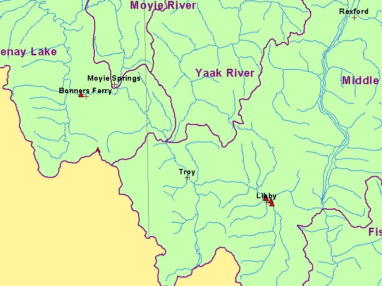
You selected the area Basin-wide and the topic Map: 8. NPDES Water Pollution Point Sources, U.S. Kootenai Basin |
| This is a map of National Pollution Discharge Elimination System (NPDES) water pollution sites, which are mostly near towns and a 1:250,000 scale stream layer for the U.S. portion of the Kootenay River basin. Data were provided by the U.S.F.S. Interior Columbia Basin Ecosystem Management Project. Scale = 1:587,509 . | |||
|
|
||
| www.krisweb.com |