
|
Area/Topic | Bibliography | Background | Hypotheses | Home |
|
Map Page.
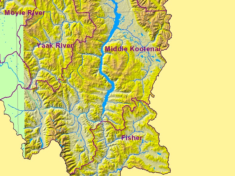
You selected the area Middle Kootenai and the topic Map: C. Hydrography with Elevation Hillshade, Mid Kootenai - Montana |
| This is a map of rivers, streams, and lakes in the Montana portion of the Middle Kootenai sub-basin, overlaid on top of a digital elevation model. Data were provided by the Kootenai River Network. Scale = 1:751,664 . | |||
|
|
||
| www.krisweb.com |