
|
Area/Topic | Bibliography | Background | Hypotheses | Home |
|
Map Page.
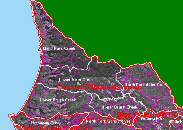
You selected the area Coastal Tributaries North and the topic Sediment: Road Densities Coastal No. Calwater Planning Watersheds 2001 |
| This is a map of the roads in the Coastal Tributaries North sub-basin, overlaid on top of KRIS sub-basins, Calwater Planning Watersheds, and Digital Orthophoto Quadrangles. The actual number of roads is under-represented because the roads layer is not fully comprehensive. Data were contributed by Redwood National Park, California Department of Forestry (CDF), and the United States Geologic Survey (USGS). | |||
|
|
||
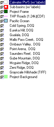
To view metadata about a map layer, click on a link in the table below.
| Name of Layer in Map Legend | Metadata File Name |
|---|---|
| Calwater PWS (w/ labels) | calw22.shp.txt |
| Sub-basins (w/ labels) | subbasins.shp.txt |
| Project Frame | Unavailable |
| THP Roads (1:24k)(CDF) | roads_thp.shp.txt |
| Topo Map (1:24k scale)(USGS) | Unavailable |
| Pacific Ocean | Unavailable |
| Cold Spring, DOQ | coldspring.sid.txt |
| Eureka Hill, DOQ | eurekahill.sid.txt |
| Gualala, DOQ | gualala.sid.txt |
| Mallo Pass Creek, DOQ | mallopass.sid.txt |
| Ornbaun Valley, DOQ | ornbaun.sid.txt |
| Point Arena, DOQ | pointarena.sid.txt |
| Saunders Reef, DOQ | saundersreef.sid.txt |
| Gube Mountain, DOQ | gubemtn.sid.txt |
| Mcguire Ridge, DOQ | mcguire.sid.txt |
| Zeni Ridge, DOQ | zeniridge.sid.txt |
| Grayscale Hillshade (TIFF) | grayscale.tif.txt |
| Project Background | Unavailable |
| www.krisweb.com |