| Area | Coastal Tribs |
| Topic | Tour: Aerial and Ground Photos of 1975 Logging |
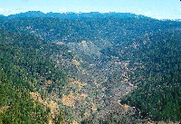 Click on image to enlarge (446K).
NW25 Mar77 - Aerial view of Juan Cr. devastated by Louisiana Pacific clearcuts, looking east. Photo # Nicholas Wilson,707-937-0137, PO Box 943, Mendocino CA. Scanned from 35mm transparency. LDW67.
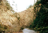 Click on image to enlarge (425K).
NW23 Mar75 - Juan Cr. clearcut by Louisiana Pacific in progress. Stream level view looking east. Photo # Nicholas Wilson,707-937-0137, PO Box 943, Mendocino CA. Scanned from 35mm transparency. LDW67
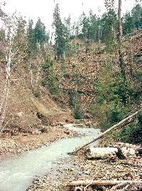 Click on image to enlarge (508K).
NW24 Mar75 - Juan Cr. clearcut by Louisiana Pacific in progress. Timber felled into stream. Ground level view looking east. Photo # Nicholas Wilson,707-937-0137, PO Box 943, Mendocino CA. Scanned from 35mm transparency. LDW69
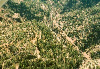 Click on image to enlarge (588K).
NW27 Mar77 - Aerial view of Usal Cr., with extreme soil disturbance by Georgia Pacific tractor logging. Photo # Nicholas Wilson,707-937-0137, PO Box 943, Mendocino CA. Scanned from 35mm transparency. LDW76
 Click on image to enlarge (485K).
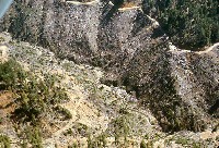
NW22 Mar77 - Extreme soil disturbance in Juan Cr. clearcuts by Louisiana Pacific. Note road bulldozed across active slide lower left. Aerial view looking south. Photo # Nicholas Wilson,707-937-0137, PO Box 943, Mendocino CA. Scanned from 35mm transparency. LDW63
 Click on image to enlarge (556K).
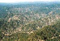
NW26 Mar77 - Aerial view of Little Bear Cr., Bear Cr. and Chimney Rock Cr. tribs to Usal Cr. looking northwest. Heavy tractor clearcuts and extreme soil disturbance by Georgia Pacific. Note old growth areas at lower and upper middle right, cut later. Chimney Rock is visible at upper middle left, 20% in from left, 60% up from bottom.. Photo # Nicholas Wilson,707-937-0137, PO Box 943, Mendocino CA. Scanned from 35mm transparency. LDW74
To learn more about this topic click here
| www.krisweb.com |
