|
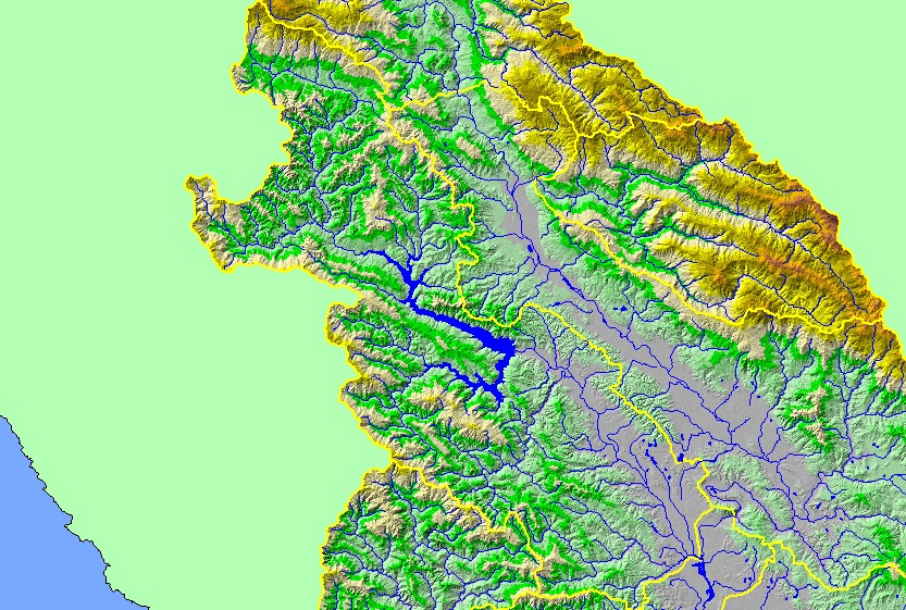
This is a map of the 1:100,000 scale U.S. Geologic Survey hydrography in the Warm Springs sub-basin, displayed with a Digital Elevation Model (DEM) showing the
topography of the landscape. The valley at the eastern edge of the sub-basin is the Dry Creek valley. Most of the sub-basin is steep terrain, with elevations up to 1000
meters. Warm Springs Dam blocks anadromous fish access to the upper half of the sub-basin. Data were contributed by the U.S. Geological Survey and the California
Department of Forestry.
|
|