|
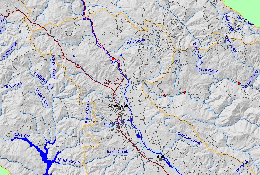
This map shows locations of photographs taken by Pat Higgins in the northern half of the Geyserville sub-basin in June 2002 and July 2003, displayed with sub-basin
outlines, 1:100,000 scale streams, roads, and a grayscale hillshade. The points are hotlinked to picture tour topics. To view a tour, click on a red point. Click the check
box next to a layer to toggle it on/off. Other available themes include labeled Roads, Vegetation Size, Topographic Maps, Calwater Planning Watersheds, and 1:24,000
streams. Scale = 1:108,686 .
|
|