
| Area | Geyserville |
| Topic | Sediment: Road Stream Crossing Density for Geyserville Calwaters |
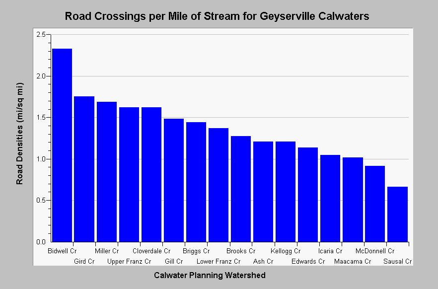
| Caption: The chart above shows a summary of the densities of road crossings per stream mile for Geyserville Calwater Planning Watersheds. Stream crossing density varies from 0.66 in Sausal Creek to 2.33 in , Bidwell Creek. Road and stream data originates from 1:24,000 scale topographic maps and under represent road densities, especially in urban and timber harvest areas. Roads densities are calculated by KRIS IFR staff in Arc Info. See Map for a map layer of basin wide roads. See InfoLinks for more information. | |
 |
To learn more about this topic click Info Links .
To view additional information (data source, aquisition date etc.) about this page, click Metadata .
To view the table with the chart's data, click Chart Table web page.
To download the table with the chart's data, click roads_russian_geyserville_24k.dbf (size 4,134 bytes) .
To view the table with the chart's source data, click Source Table web page.
To download the table with the chart's source data, click roads_russian_calwaters_24k.dbf (size 27,124 bytes)
| www.krisweb.com |