|
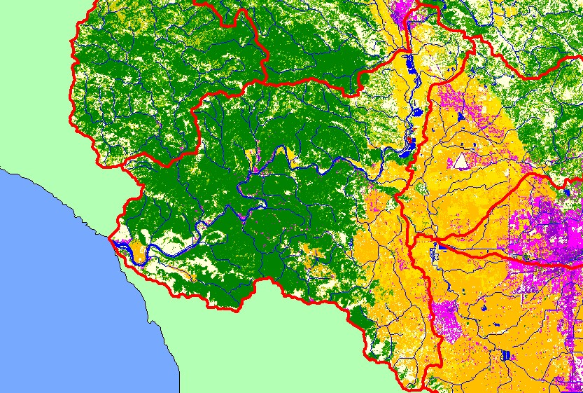
This is a map of EPA Landcover/Landuse in the Guerneville sub-basin, based on a 1992 Landsat TM satellite image. Residential development (pink) in the sub-basin is
located mostly along the Russian River and also the eastern edge of the sub-basin. Most the Dry Creek valley is covered in vineyards, orchards, and other agriculture.
The center and west of the sub-basin are covered by conifer forest, except for the grasslands near the mouth of the Russian River. Data were provided by the U.S.
Environmental Protection Agency.
|
|