| Area | Upper Noyo |
| Topic | Tour: Images of Upper Noyo Riparian Maps (USFS Landsat) |
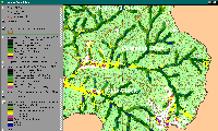
The riparian zone of the McMullen Creek CalWater is shown above as a 90-meter clip of USFS vegetation and stand type data derived from a 1994 Landsat image. Medium-large trees (20-29.9" diameter) dominate many reaches except for the lower mainstem, which is shown as saplings 5" diameter, and non-forest. The non-forest and saplings in the southern headwaters are likely related to natural grasslands, which show up on the USGS topo backdrop in white. See InfoLinks for more information. This data is only accurate to the one-hectare scale and should be used only as a reconnaissance tool for riparian conditions.
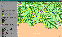
The riparian zone of the Olds Creek CalWater is shown above as a 90-meter clip of USFS vegetation and stand type data derived from a 1994 Landsat image. Medium-large trees (20-29.9" diameter) dominate parts of the upper mainstem riparian zone. Saplings (<5" diameter) and Non-Forest are predominant in lower reaches of Olds Creek and in some tributaries in this CalWater. See InfoLinks for more information. This data is only accurate to the one-hectare scale and should be used only as a reconnaissance tool for riparian conditions.
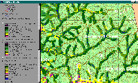
The riparian zone of the Redwood Creek CalWater is shown above as a 90-meter clip of USFS vegetation and stand type data derived from a 1994 Landsat image. Medium-large trees (20-29.9" diameter) are interspersed with small trees (5-11.9" diameter) in the mainstem Redwood Creek riparian zone. Saplings (<5" diameter) and non-forest are rare in the riparian zone of this CalWater. See InfoLinks for more information. This data is only accurate to the one-hectare scale and should be used only as a reconnaissance tool for riparian conditions.
 Click on image to enlarge (151K).
 Click on image to enlarge (128K).
 Click on image to enlarge (165K).
To learn more about this topic click here
| www.krisweb.com |
