| Area | Mainstem Trinity |
| Topic | Flow: Trinity R Bridge Winter Flood Estimates, McBain & Trush 2002 |
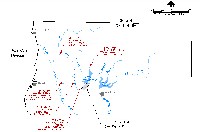
This figure shows the location of the Study Reach on the Trinity River and stream gauging stations that were used in this study: Estimation of 50-and 100-Year Tributary Accretion Floods Lewiston Dam to Treadwell Bridge, Trinity River, California (McBain and Trush, 2002).
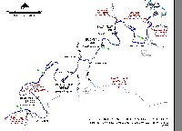
This figure shows the study reach, Trinity River gaging stations, and the bridge locations were the 50 and 100-year flood magnitude estimations were calculated in this study: Estimation of 50-and 100-Year Tributary Accretion Floods Lewiston Dam to Treadwell Bridge, Trinity River, California (McBain and Trush, 2002).
 Click on image to enlarge (140K).
 Click on image to enlarge (159K).
To learn more about this topic click Info Links
To view additional information (data source, aquisition date etc.) about this page, click Metadata
| www.krisweb.com |
