| Area | South Fork Battle |
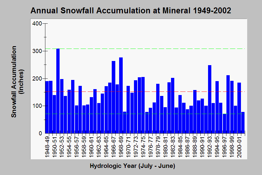
| Topic | Climate: Snowfall - Mineral - Annual Totals 1949-2002 |
| Caption: This chart shows annual snowfall accumulation (inches) at Mineral, which was arrived at by totaling all monthly snowfall data for calendar years from July-June. These totals do not reflect snow melt events, such as the January 1997 rain-on-snow storm, so high total may or may not represent high spring and summer base flows. The dashed green lines are maxima and minima and the red line is the median of all values. Data from the Western Regional Climate Center. See Info Links for more information. | |
 |
To learn more about this topic click Info Links .
To view additional information (data source, aquisition date etc.) about this page, click Metadata .
To view the table with the chart's data, click Chart Table web page.
To download the table with the chart's data, click climate_snowfall_mineral.db (size 8,192 bytes)
To download the table with the chart's data as an Excel spreadsheet, click climate_snowfall_mineral.db.xls (size 17,236 bytes) .
| www.krisweb.com |
