| Area | Basin-wide |
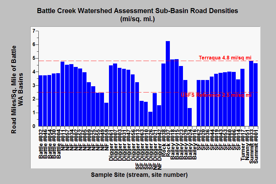
| Topic | Sediment: Road Densities by Battle WA Sub-Basin |
| Caption: This chart shows the road densities in miles/per square mile for various Battle Creek sub-basins as defined by Terraqua (2004), however, the reference line for is from both the Battle WA and Armentrout et al. (1999). The latter reflects the threshold of concern in anadromous watersheds for the Lassen National Forest. Electronic road maps of Battle Creek are not accurate in some areas, so road densities may be under-represented. Also skid trails and landings or temporary roads associated with logging activities are not included in this disturbance index (see Pictures for examples). Data from the USFS, USGS, Lassen National Park, and SPI. Summaries run by Dr. Paul Trichilo of Kier Associates. See Info Links for more information. | |
 |
To learn more about this topic click Info Links .
To view additional information (data source, aquisition date etc.) about this page, click Metadata .
To view the table with the chart's data, click Chart Table web page.
To download the table with the chart's data, click upland_source_fin_12_10_03.dbf (size 17,098 bytes)
To download the table with the chart's data as an Excel spreadsheet, click upland_source_fin_12_10_03.dbf.xls (size 28,611 bytes) .
| www.krisweb.com |
