| Area |
Regional |
| Topic |
Map: 1B. Sub-basins, West Marin-Sonoma |
|
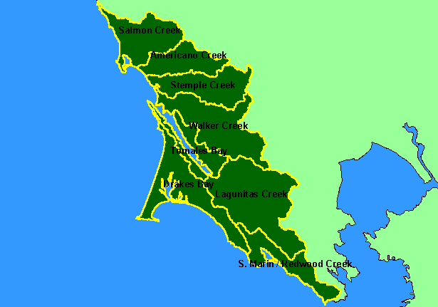
This is a map of the eight KRIS sub-basins broken out as study areas in the KRIS West Marin-Sonoma Map project. The Salmon
Creek sub-basin is the furthest north and contains Salmon Creek and Bodega Bay. The Tomales Bay sub-basin covers both sides of
the bay. Most of the Drakes Bay sub-basin is within the Point Reyes National Seashore, while Bolinas Lagoon, Muir Woods and
Redwood Creek fall within the Southern Marin basin. Scale = 1:620,843 .
|
|
|
 |
 |
To view metadata about a map layer, click on a link in the table below.
| Name of Layer in Map Legend | Metadata File Name |
|---|
| Subbasins (w/ labels) | subbasins.shp.txt |
| Frame Project Outline | Unavailable |