|
Area/Topic | Bibliography | Background | Hypotheses | Home |
Photo Pages: Meta Information
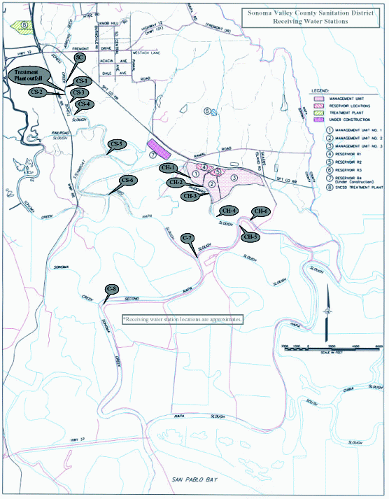
This page contains detailed information from the KRIS Photodatabase table about photos from sub-basin Sonoma Creek and series Monitoring: WQ- Monitoring Stations Map of SVTP Receiving Water (Schell Slough) 1997. For a list of photo pages sorted by series, click here. For a list of photo pages sorted by sub-basin, click here.
| Basin | East Marin-Sonoma |
| Caption | This image shows the vicinity of Sonoma Valley Treatment Plant with respect to Sonoma Creek and San Pablo Bay. Map also includes water quality sampling locations. |
| CaptionTemplate | [Description] |
| Category | Monitoring |
| Description | This image shows the vicinity of Sonoma Valley Treatment Plant with respect to Sonoma Creek and San Pablo Bay. Map also includes water quality sampling locations. |
| Filename | svtp_recwat_sites.gif |
| Filesize | 89470 |
| Meta_Id | SCWA_wq |
| Notefile | emarins.htm#SCWA_wq |
| Path | topics/sc/svtp_recwat_sites.gif |
| Photo Number | 1 |
| Restriction | None |
| Series | Monitoring: WQ- Monitoring Stations Map of SVTP Receiving Water (Schell Slough) 1997 |
| SubBasin | Sonoma Creek |
| UpdateDate | 8/26/2006 |
| UpdateName | JEA |
| www.krisweb.com |